Up to £2 million available for riverine relief
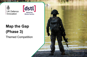
UK Defence Innovation (UKDI) spouští novou tematickou soutěž Map the Gap (Phase 3), kterou pořádá Defence Science and Technology Laboratory (Dstl) ve spolupráci s Britskou armádou, s cílem získat návrhy na dálkové posuzování stability terénu a říčního profilu pro bezpečné průchody pozemních jednotek. Celkový rozpočet soutěže činí až 2 miliony liber (bez DPH) a je očekáváno financovat 3–4 projekty na dobu až 15 měsíců; uzávěrka podání návrhů je 16. června 2026 ve 12:00 BST. Hlavními výzvami jsou měření Ground Bearing Capacity z bezpilotního letounu (UAS) a podvodní profilování řeky pomocí senzorů na UAS. Doprovodné akce zahrnují úvodní webinář 5. května 2026 a individuální konzultace 13. a 15. května 2026.
Dstl, in partnership with the British Army, is seeking innovative solutions to remotely assess diverse terrain for safe passage.
- UKDI has launched a new Themed Competition: Map the Gap (Phase 3)
- Funded by the Defence Science and Technology Laboratory (Dstl)
- Up to £2 million (excluding VAT) funding available
- Competition closes midday 16 June 2026
UK Defence Innovation (UKDI) is pleased to launch a new Themed Competition called Map the Gap (Phase 3) . Run on behalf of the Defence Science and Technology Laboratory (Dstl) in partnership with the British Army, this competition seeks proposals that can remotely assess terrain stability and riverine measurements to support safe and rapid traversing of land forces.
This competition builds on research conducted in previous ‘Map the Gap’ competition phases with a focus on accelerating novel sensing technologies deployed autonomously. Proposals are sought to develop systems toward two primary challenges:
- Measurement of Ground Bearing Capacity (GBC) from an Uncrewed Aerial System (UAS)
- Underwater river profiling from UAS deployed sensors or payloads
Learn the full details of these challenge areas in the competition document.
Key dates and funding
The deadline to submit a proposal is 12:00 midday 16 June 2026 (BST)
The total funding for this competition is £2 million (excluding VAT), with UKDI expecting to fund 3 to 4 proposals across both challenges for a contract period of up to 15 months.
Do you have a solution? Read the full competition document and submit a proposal.
Background
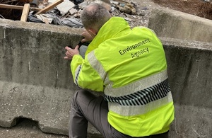
When traversing unstable terrain, Royal Engineer reconnaissance teams must assess whether the ground and riverine environments are suitable for the safe passage of vehicles via a series of measurements. Currently, these measurements are taken in person exposing soldiers to danger. This competition builds on lessons learned under the previous DASA competition “Map the Gap”, which demonstrated clear potential for remote and autonomous systems to reduce risk to personnel.
Get the full detail and submit your solution here.
Supporting events
Launch webinar: 5 May 2026
This launch webinar will provide further detail on the problem space and a chance to ask questions in an open forum. If you would like to participate, please register on the Eventbrite page.
One-to-one sessions: 13 May and 15 May 2026
A series of 15 minute one-to-one teleconference sessions, giving you the opportunity to ask specific technical questions to the competition team in a closed forum.
Registration for these sessions will be available the day after the launch webinar on 5 May 2026, on the Eventbrite page. Booking will be on a first come first served basis.
Non-technical questions about the competition process should be sent to the UKDI Help Centre, [email protected].
Submit a proposal
Do you have a novel solution for assessing the suitability and safety of traversing diverse terrain that doesn’t risk lives? Submit your proposal and find the full details here.
https://www.gov.uk/government/news/up-to-2-million-available-for-riverine-relief